Welcome to the Earthdata Forum! Here, the scientific user community and subject matter experts from NASA Distributed Active Archive Centers (DAACs), and other contributors, discuss research needs, data, and data applications.
by simkins » Thu Apr 12, 2018 2:58 pm America/New_York
I'm trying to process some raw VIIRS data, correct the bow-tie effect by using the default flags in l2bin, and run l3mapgen to create an image. Here is my code:
Unfortunately, it fails at the l2bin step and doesn't fill any bins total_filled_bins: 0
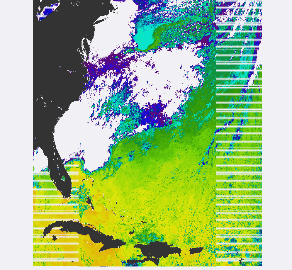
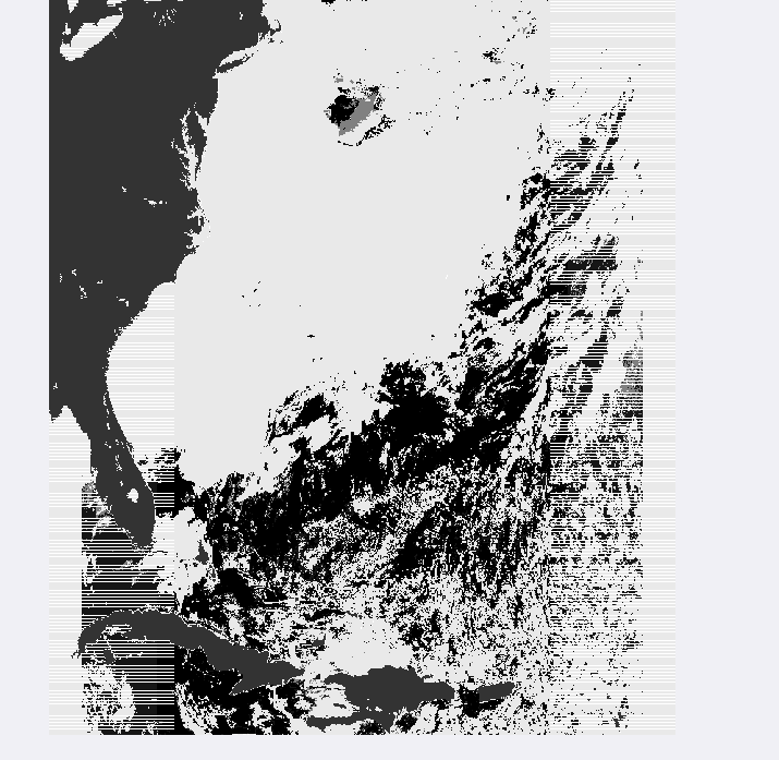
Taking a look at the output from l2gen in seadas, there seems to be plenty of data to run l2bin (see sst.png and qual_sst.png).
Anyone see a problem in my code resulting the failure of l2bin? I also tried l2binning through seadas, but was unsuccessful. Again, my motivation for using l2bin is to remove the bowtie effect from VIIRS.
You seem to be using "IDPS-derived" VIIRS SDR inputs (i.e. NOAA generated). The l2gen reader for those has not been updated to properly set the BOWTIEDEL flag. I'm not sure what l2gen would spit out for that flag given those inputs. You could check the L2 (use the Masks feature in SeaDAS to display the BOWTIEDEL flag).
BTW, resolution=1000 is a MODIS-only input option for l2gen. You don't need to set it. Most of the other options you've set are default values and also don't need to be set.
Yes, we do. We receive Level-0 VIIRS data from EDOS from which we generate the NASA-formatted Level-1 files (which we also distribute). I'd recommend you just grab the L1 data we distribute. You can also set up a subscription to receive data that cover your region of interest.
by simkins » Mon Apr 16, 2018 11:10 am America/New_York
Hi Sean,
I guess my question now becomes; how do you generate the Level 1 NASA-formatted files?
We have our own receiving station where we collect raw VIIRS data, generate level 0, 1 and then use l2gen for level 2. We use SeaDAS for the processing. We'd like to use our own raw data instead of EDOS to cut down on latency time, but we're running into processing issues hence the initial post. Are the EDOS files different than ours? Or is there a level 1 to level 2 processing step that you guys use that is different?
Well, that's a DRL question...According to the DRL IPOPP v2.6 documentation, it can do it:
"This document provides instructions for installing and operating the IPOPP software. IPOPP can ingest JPSS and SNPP Raw Data Record (RDR), JPSS and SNPP Visible Infrared Imaging Radiometer Suite (VIIRS) and Ozone Mapping Profiler Suite (OMPS) Production Data Set (PDS) files, and Terra/Aqua PDS files. "
(The data we get from EDOS are PDS files)
Just out of curiosity, what is you perceived latency requirement?