Page 1 of 1
No L3 MODIS Aqua RRS Data For Southern New Zealand in June
Posted: Wed Jul 22, 2020 8:32 am America/New_York
by erik_johnson
Hello,
Recently I downloaded the entire record of MODIS Aqua RRS data extracted for 45S-47S, 169E-172E using the level 3 browser. However, this data set does not include many May/July images, and effectively nothing for June. Is this a result of some southern limit on processing data in the Austral winter? When I place the data request, it lists June files in the "Files to be delivered", however they are not present in the final download.
When requesting specifically June files for a given year with this extraction area, I receive a "This is to inform you that we were unable to stage any files for this order" error.
Am I missing something?
No L3 MODIS Aqua RRS Data For Southern New Zealand in June
Posted: Wed Jul 22, 2020 9:02 am America/New_York
by OB.DAAC-EDL - SeanBailey
No sun....well, not enough. There is a flag set for high solar zenith angle, which is defined as 70 degrees for our standard ocean color processing. Data flagged by that condition are excluded from L3 binning. What isn't flagged by that are flagged as clouds. Below is an image showing your region and the monthly composite chlorophyll L3 product for June 2020. No data.
Sean

No L3 MODIS Aqua RRS Data For Southern New Zealand in June
Posted: Wed Jul 22, 2020 4:13 pm America/New_York
by erik_johnson
Thanks for the reply Sean! If I were to undertake processing myself via SeaDAS (I'm interested in getting 645nm at 500m for river plume tracking), would I be able to retrieve data from this region for June?
No L3 MODIS Aqua RRS Data For Southern New Zealand in June
Posted: Wed Jul 22, 2020 5:23 pm America/New_York
by OB SeaDAS - knowles
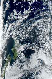
Very likely, yes you can find data there in June at higher resolutions. I just used the L2 browser
https://oceancolor.gsfc.nasa.gov/cgi/browse.pl and did a quick visual scan of the true color (TC) images and found many files for June 2020 matching your region (most of them cloudy but not all). The level2 MODIS files available are at 1km (nadir) resolution. For the 645nm band to achieve 500m or 250m you would need to get the L1A files and process them.
This is my browser results for the full MODIS Aqua mission for June using your region which returns over 900 files (most of them cloudy but not all):
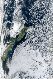
https://oceancolor.gsfc.nasa.gov/cgi/browse.pl?sub=level1or2list&per=CSTM&day=11839+30+12204+30+12570+30+12935+30+13300+30+13665+30+14031+30+14396+30+14761+30+15126+30+15492+30+15857+30+16222+30+16587+30+16953+30+17318+30+17683+30+18048+30+18414+30&prm=TC&set=10&ndx=2&mon=12234&sen=amod&rad=0&frc=0&n=-45&s=-47&w=169&e=172&wid=170&hgt=254&id=1595452252.28909&cn=-44.46&cs=-47.66&cw=168.15&ce=172.03&dnm=DHere's two files in your region:
A2020166021000.L2_LAC_OC.nc
A2020175020500.L2_LAC_OC.nc