Welcome to the Earthdata Forum! Here, the scientific user community and subject matter experts from NASA Distributed Active Archive Centers (DAACs), and other contributors, discuss research needs, data, and data applications.
This page provides links to access tools and services that the ASDC offers for data downloading, reformatting, and visualization. These applications include:
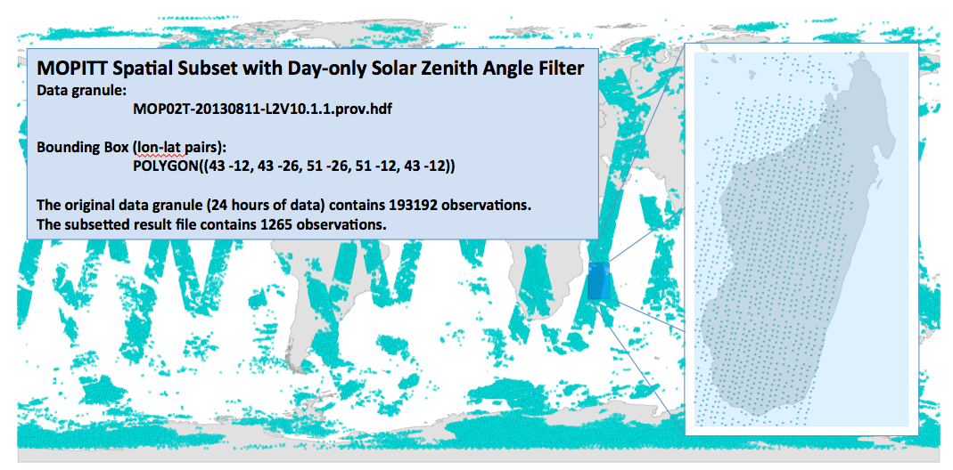
Subsetting
The ASDC Subsetters provides the user with three subsetting options that can be used individually or in combination with one another. This includes parameter groupings, temporal (date and time) and geospatial.
Provides users with ability to select and order MISR data by date, time, and geolocation. Reformatter code provided by JPL and is complied at the ASDC.
Provides visualization for data of various ASDC products, as well as publicly available applications and services. These applications include StoryMap, Dashboards, Dashboards Classics, Experience Builder, Field Maps, Map Viewer, Map Viewer Classic, Quick Capture, Sites, and Workforce.
Shapefile (ZIP archive containing all shapefiles)
CSV or TXT files with optional address, place or coordinate locations (comma, semi-colon or tab delimited
GPX (GPS Exchange Format)
GeoJSON (open standard format for simple geographical features)