Page 1 of 1
Automatic 2.25km buffer when .5 or 1 km input
Posted: Thu Jun 09, 2022 7:35 pm America/New_York
by madschony
I'm trying to use the MODIS/VIIRS Land Products Global Subsets tool within EarthData to extract data around latitude and longitude points using buffers of .25km, .5km, and 1km. Things have been fine with a .25km buffer in that the citation appears correctly once run. However, when I try to input a buffer of .5km or 1km, it automatically produces data with a citation appearing indicating a buffer of 2.25km, even though that is not what I input and told the system to do. Is this a bug in the system? Will this be fixed with the maintenance that is occurring today? I'm hoping for some answers so that I may progress with my data collection.
Re: Automatic 2.25km buffer when .5 or 1 km input
Posted: Thu Jun 16, 2022 11:59 am America/New_York
by rupeshornl
Hi
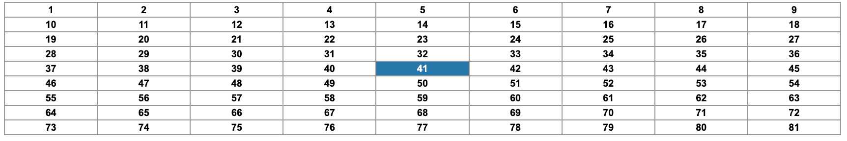
@madschony, Thank you for contacting us. The Global Subsets tool only allows setting the x (E-W) and y (N-S) as integers. If you order a subset with x and y as 1km for MOD13Q1, it should result in a subset size of 2.25km x 2.25km with a total of 81 pixels. The 41st pixel (center) will be your 0.25x0.25km subset, and you can retrieve pixels for other subset sizes accordingly. I have attached an example numbering scheme with this email. Please refer to
https://modis.ornl.gov/documentation.html#data_format for more information on the data format. Let us know if you are still having issues.
- subset_grid_numbering.png (57.29 KiB) Not viewed yet