Welcome to the Earthdata Forum! Here, the scientific user community and subject matter experts from NASA Distributed Active Archive Centers (DAACs), and other contributors, discuss research needs, data, and data applications.
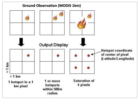
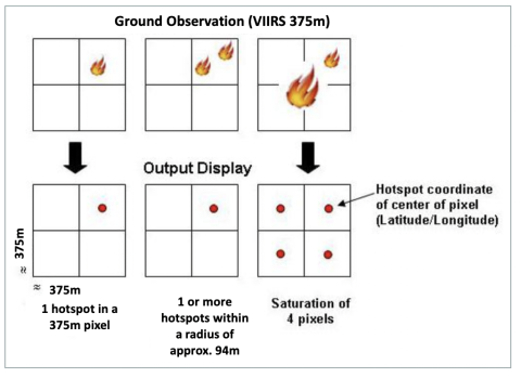
Satellites take a ‘snapshot’ of events as they pass over Earth. Each hotspot/active fire detection represents the center of a pixel flagged as containing one or more fires or other thermal anomalies (such as volcanoes). For MODIS the pixel is approximately 1 km and for VIIRS the pixel is approximately 375 m. The “location” is the center point of the pixel (not necessarily the coordinates of the actual fire). The actual pixel size varies with the scan and track (see: What does scan and track mean?). The fire is often less than the size of the pixel (see: What size fires can be detected?). We are not able to determine the exact location or size of the fire; what we do know is that at least one fire is located within the flagged pixel. Sometimes you will see several active fires in a line. This generally represents a fire front.