ABoVE: Alaska Lake and Pond Occurrence
The Alaska Lake and Pond Occurrence Dataset (ALPOD) is a spatially explicit map of lakes and ponds across Alaska and their seasonal fluctuations. The core product is an open water occurrence raster that: (a) separates lakes and ponds from other components of the landscape (e.g., rivers and wetlands); (b) is built from Sentinel-2 imagery and has 10-m resolution; and (c) records the percentages of time that each pixel was open water and attached to a lake or pond during the 2016-2021 ice-free seasons at near-daily temporal resolution.

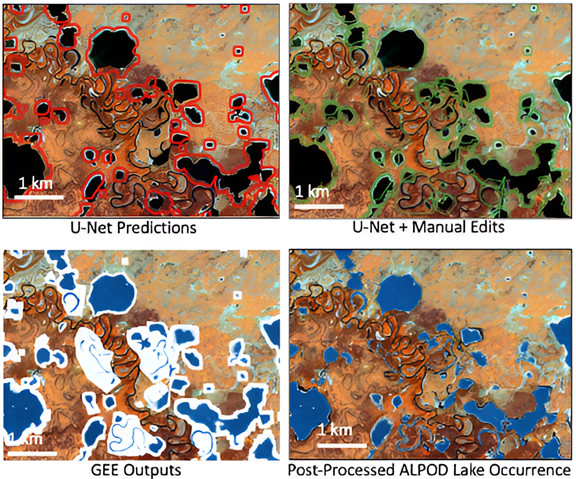
Figure 1. Dataset construction progression starting with the U-Net predictions(upper left). Manual edits to the U-Net outputs produce the maximum possible lake extent mask (upper right). The lower left panel shows the output of the Google Earth Engine (GEE) processing that classifies open water in every available image within the maximum lake mask. Lastly, the final lake occurrence image is produced by applying a watershed segmentation algorithm to the GEE outputs. Note the areas within the maximum possible lake extent mask (green) that are excluded from the final lake occurrence dataset. These areas had low open-water occurrence values and were filtered by the watershed segmentation post-processing algorithm.
Citation: Levenson, E., S.W. Cooley, and A. Mullen. 2025. ABoVE: Alaska Lake and Pond Occurrence. ORNL DAAC, Oak Ridge, Tennessee, USA. https://doi.org/10.3334/ORNLDAAC/2399
